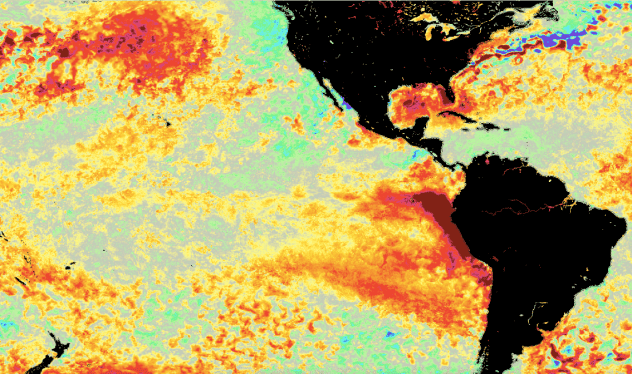
Image: Sea surface temperature anomalies for April 12, 2023. Yellow, orange and red indicate where water is warmer than historical averages, and green, blue and purple show where water is cooler than historical averages. (NASA Worldview)
Big changes are unfolding in the Pacific Ocean, and the result could have significant implications for the Atlantic hurricane season and the upcoming winter in North America.
The Pacific Ocean is getting warmer, and the rising water temperatures have spurred forecasters to issue the first El Niño watch in years. AccuWeather meteorologists say that the emerging phenomenon will play a pivotal role in dictating the weather patterns for North America and beyond through the upcoming winter.
El Niño is part of a regular climate cycle known as the El Niño-Southern Oscillation (ENSO). It occurs when sea surface temperatures in the equatorial eastern Pacific rise to above-average levels for an extended period of time. Its cooler counterpart, La Niña, is declared when water temperatures in this zone of the Pacific Ocean are below historical averages for months at a time. When the water temperatures are right around the long-term averages, forecasters say the ENSO is neutral.
NOAA’s Climate Prediction Center (CPC) issued a report on […]
Full article: El Nino watch issued: Here’s how it could affect weather in the US

