This is part two of the series “Building Land in Coastal Louisiana: Expert Recommendations for Operating a Successful Sediment Diversion that Balances Ecosystem and Community Needs.” Please follow the link below for the original(s).
Historically, the Mississippi River has periodically overtopped its natural levee and flooded the adjacent wetlands with sediment-laden water. This natural process has been interrupted by the construction of flood control levees, and the available sediment has been reduced by the construction of upriver reservoirs.
The proposed introduction of diversions from the river to the wetlands in Louisiana is intended to restore some of the natural supply of sediment to compensate for subsidence and sea level rise and help rebuild land.
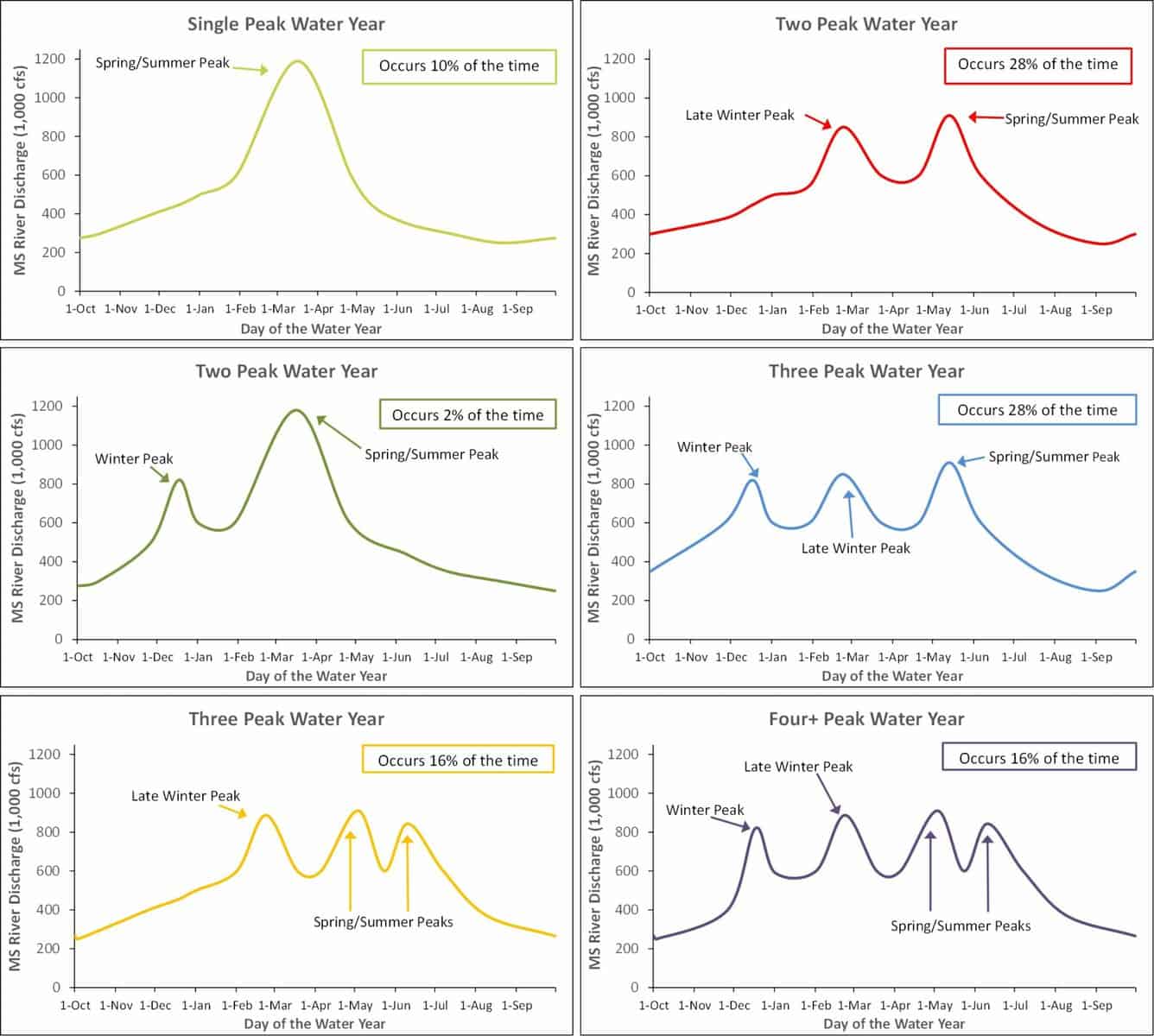
The Mississippi River typically has one to four high-water peaks between November and June. The rising limb of the first peak during this period tends to have the highest silt-clay concentrations. However, since the highest river flows occur on average in March, the largest sediment loads occur in this period.
The highest sand concentrations in the river occur during the rising limbs and the peaks of the floods and tend to decrease on the falling limb of the floods. If the goal is to divert the […]
Full article: Exploring the Hydrodynamics of a Sediment Diversion at Mid-Barataria
More about ground subsidence and water usage:
Animation of Satellite Data Shows SoCal “Breathing” Water
Sinking land, poisoned water: the dark side of California’s mega farms
The Valley floor is sinking, and it’s crippling California’s ability to deliver water
Mississippi River Sediment Diversions & Louisiana


