
Northern California’s surface water is relatively easy to track. Mainly because we can see it: accumulating in the snowpack and flowing into reservoirs, rivers and other bodies of freshwater.
By comparison, keeping tabs on groundwater is much harder because it exists deep beneath our feet in various aquifers and well systems.
Yet tracking that groundwater is crucial to anticipating the water supply for the state in the short term but especially in the long term. During dry years, groundwater can account for up to 60% of the state’s drinking water availability.
Following years of drought and decades of over-pumping, that groundwater is severely depleted. Just last year, scientists with NASA’s Jet Propulsion Laboratory discovered that California’s groundwater likely reached a new low.
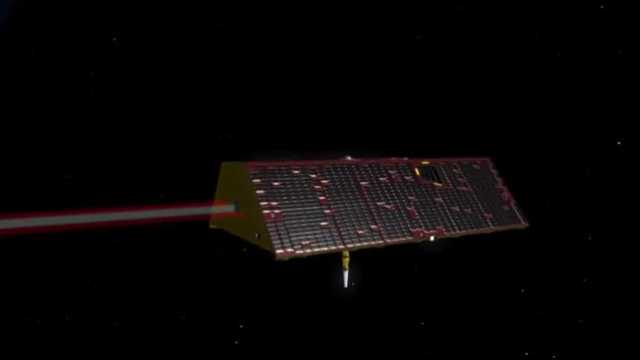
Felix Landerer is one of the NASA scientists who analyzed that data as part of the ongoing GRACE Follow-On satellite mission, which launched in 2018.
“What we saw in the data up to November is this long-term decline and in fact, we think our first preliminary analysis shows us that November in 2022 was a new record low for water storage,” Landerer said.
The GRACE-FO mission, short for Gravity Recovery and Climate Experiment Follow-On, comprises two twin […]
Full article: These 2 NASA satellites are ‘smart water meters’ that can track groundwater in Northern California
Clean water is essential for life, yet millions of Americans unknowingly consume contaminants through their…
Human brains contain higher concentrations of microplastics than other organs, according to a new study, and the…
From the Office of the Governor: In anticipation of a multi-day, significant atmospheric river in Northern California,…
From Governor Newsom: Scientists, water managers, state leaders, and experts throughout the state are calling…
Photo: A harmful algal bloom in Milford Lake, Kansas, made the water appear bright green.…
An expanded plastic foam coffee cup is at a donut shop in Monterey Park, California.…