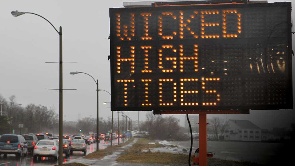

Photo: ON THE RISE Bostonians are getting used to flooding. Morrissey Boulevard (shown), near the campus of University of Massachusetts Boston, gets hit several times a year during high tides. DAVID L. RYAN/BOSTON GLOBE/GETTY IMAGES
Boston dodged a disaster in 2012. After Hurricane Sandy devastated parts of New Jersey and New York, the superstorm hit Boston near low tide, causing minimal damage. If Sandy had arrived four hours earlier, many Bostonians would have been ankle to hip deep in seawater.
Across the globe, sea levels are rising, delivering bigger storm surges and higher tides to coastal cities. In Boston, the most persistent reminder comes in the form of regular “nuisance” flooding — when seawater spills onto roads and sidewalks during high tides. Those nuisance events are harbingers of a wetter future, when extreme high tides are predicted to become a daily occurrence.
“The East Coast has been riding a post-Sandy mentality of preparing and responding before the next big one,” says Robert Freudenberg, an environmental planner at the Regional Plan Association, an urban research and advocacy firm based in New York City. But a more enduring kind of threat looms. “Sea level rise is the flooding that doesn’t go away,” he says. “Not that far in the future, some of our most developed places may be permanently inundated.”
And Boston, for one, is not waiting to get disastrously wet to act. In the seven years since Hurricane Sandy’s close call, the city-run Climate Ready Boston initiative has devised a comprehensive, science-driven master plan to protect […]
Full article: With nowhere to hide from rising seas, Boston prepares for a wetter future
Clean water is essential for life, yet millions of Americans unknowingly consume contaminants through their…
Human brains contain higher concentrations of microplastics than other organs, according to a new study, and the…
From the Office of the Governor: In anticipation of a multi-day, significant atmospheric river in Northern California,…
From Governor Newsom: Scientists, water managers, state leaders, and experts throughout the state are calling…
Photo: A harmful algal bloom in Milford Lake, Kansas, made the water appear bright green.…
An expanded plastic foam coffee cup is at a donut shop in Monterey Park, California.…