
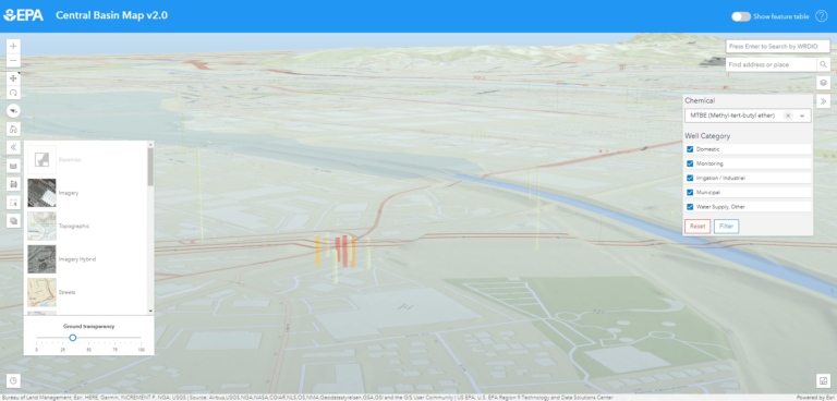
Map: A 3D view with basemap transparency adjusted to show underground wells, with filtering by chemical and the category of...
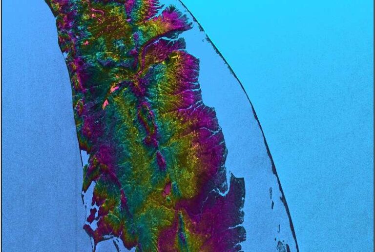
Joint NASA mission: first stunning views of Earth’s surface water
Image: This visualization shows water features on New York’s Long Island—shown as bright pink splotches. Purple, yellow, green, and dark...
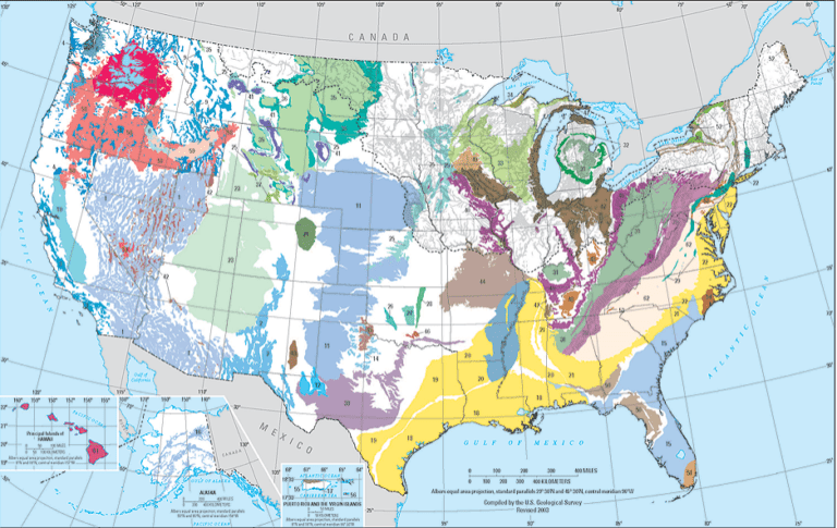
Principal Aquifers of the United States
This principal aquifers map is available for download as a wall-map-sized PDF (14.4 MB), a printable PDF (1.7 MB), or...

Let’s turn the high seas into the world’s largest nature reserve
TED Talk: What if we could save the fishing industry and protect the ocean at the same time? Marine ecologist...
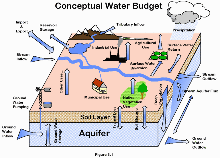
Mapping your water supply
Excerpt of the ‘Ecological Design Dimension’ of Gaia Education’s online course in ‘Design for Sustainability’ Water is used by agriculture,...