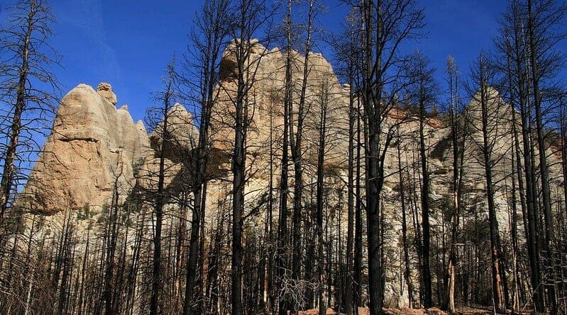

Photo: Site of the Brian Head wildfire in Utah still showing clear impacts more than a year after the fire Image Credit: arbyreed (CC BY-NC-SA 2.0). Article: Maina, F. Z., & Siirila‐Woodburn, E. R. (2020). Watersheds dynamics following wildfires: Nonlinear feedbacks and implications on hydrologic responses. Hydrological Processes , 34 (1), 33-50. https://doi.org/10.1002/hyp.13568
For people in the western United States, images of devastating wildfires have become a terrifyingly familiar part of the annual news cycle. While the fires themselves can be dangerous and damaging to the communities where they occur, the impacts are not limited to when the flames are burning. With long-lasting changes to the landscape, fires can also change the way in which water moves through the landscape for months and years afterwards. When thinking about how water moves through an area, scientists often think in terms of a watershed, which is the area of land for which any rain that falls on that surface will eventually drain to the same point, such as a large lake or river.
Understanding processes happening within watersheds and how they could be affected by fires is important since changes to these processes impact water supplies, both for communities that lie within the bounds of the watershed, as well as communities further downstream. Some of the main processes within a watershed involve water entering through both rainfall and snowfall. Water can then go down into the ground and be stored as groundwater, or become runoff at the surface and end up in streams and rivers. Under normal conditions, plants also take up some of the water from the ground in a process called transpiration. This uptake of water, along with the loss of water from the ground that occurs from evaporation as soils dry out, is together referred to as evapotranspiration. However, if there are no plants, such as after a fire, the amount of evapotranspiration will be a lot less.
In a study by Fadji Maina and Erica Siirila-Woodburn from Lawrence Berkeley National Laboratory, they explored how a watershed could be impacted by wildfires. Specifically, the scientists investigated the […]
Full article: The burning question: How do wildfires impact watersheds?
Clean water is essential for life, yet millions of Americans unknowingly consume contaminants through their…
Human brains contain higher concentrations of microplastics than other organs, according to a new study, and the…
From the Office of the Governor: In anticipation of a multi-day, significant atmospheric river in Northern California,…
From Governor Newsom: Scientists, water managers, state leaders, and experts throughout the state are calling…
Photo: A harmful algal bloom in Milford Lake, Kansas, made the water appear bright green.…
An expanded plastic foam coffee cup is at a donut shop in Monterey Park, California.…